-
Alta - Brighton Ski Tour Poster (23"x29")Smart ski tour route selection is banking on good overviews of terrain and the Alpentech aerial poster series are meant to get people in and out of the beautiful Wasatch backcountry safely. Overhead photos become a helpful mountaineering reference for charting and memorizing pitfalls...
- $34.50
- $34.50
- Unit price
- per
-
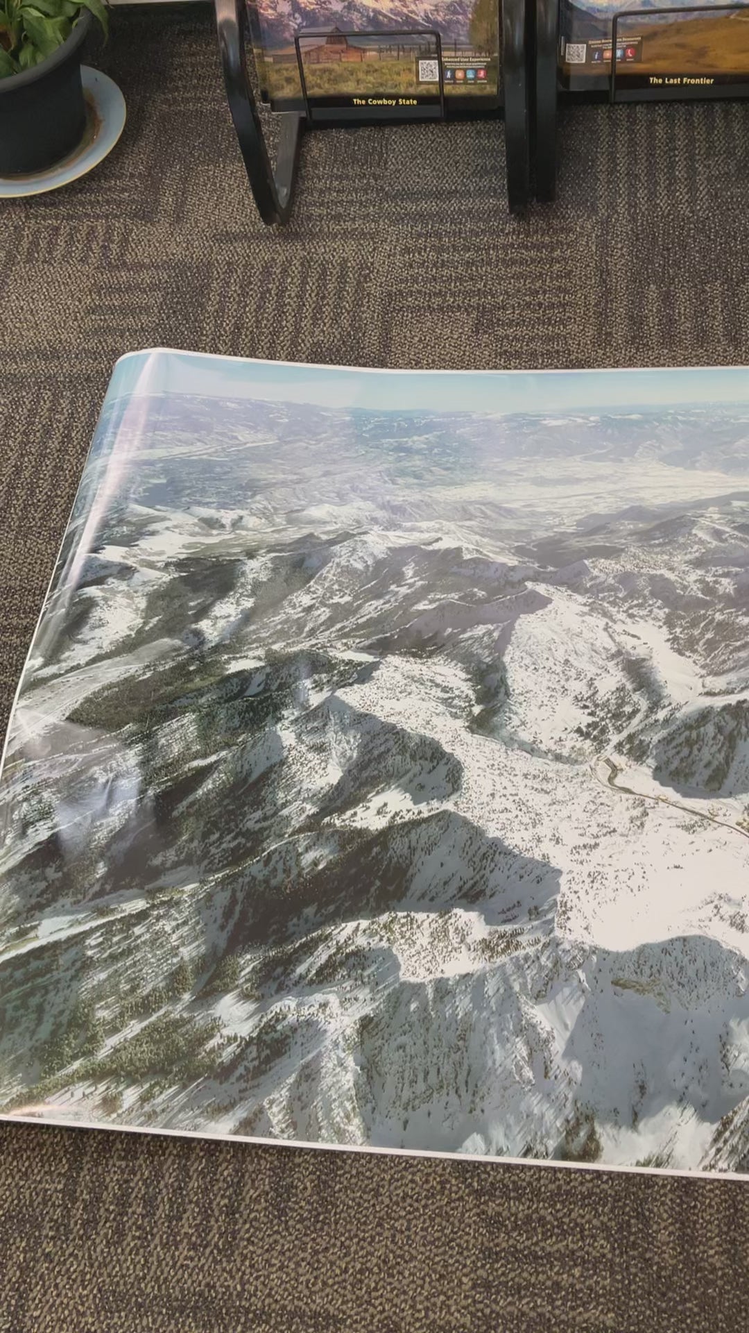
Salt Lake County Ski Areas Poster (54"x36")Salt Lake County Ski Areas Poster Viewed from 20,000 feet and looking south.
- $62.50
- $62.50
- Unit price
- per
-
Wasatch Peaks PanoramaCapture the Majesty of the Wasatch with Alpentech's Park City Panorama! Immerse yourself in the breathtaking beauty of the Wasatch Range with this stunning panorama from Alpentech, right here in our beloved Park City. This isn't just a print; it's a window to the...
- $74.50
- $74.50
- Unit price
- per
-
The Avalanche Handbook 4th EditionThe Avalanche Handbook needs no introduction. For this new fourth edition of the course-adopted and internationally recognized book, David McClung has completed an in-depth review and update of the entire text, as well as consulted outside experts in explosives, search and rescue, and other key...
- $32.95
- $32.95
- Unit price
- per
-
Wasatch Touring Map 1Discover the rugged and accessible beauty of the central Wasatch Front with the "Wasatch Touring Map 1," a comprehensive topographical guide produced by Alpentech in 2007. Focusing on the mountains immediately east of Salt Lake City, this map covers a region renowned for its...
- $12.00
- $12.00
- Unit price
- per
-
Stansbury Touring MapUncover the hidden gems and rugged landscapes of the Stansbury Mountains with the "Stansbury Touring Map," a comprehensive topographical guide produced by Alpentech in 2001. This meticulously crafted map unveils the unique beauty and recreational opportunities within this often-overlooked range, located west of the...
- $12.00
- $12.00
- Unit price
- per
-
Wasatch Touring Map 3Unleash the spirit of adventure in the heart of Utah's stunning Wasatch Range with the Wasatch Touring Map 3, a meticulously crafted topographic map published by Alpen Tech, Inc. in 2017. More than just a navigational tool, this map is your passport to exploring the...
- $12.00
- $12.00
- Unit price
- per
-
Wasatch Touring Map 2Embark on an adventure through the rugged and breathtaking terrain of the central Wasatch Range, specifically within the boundaries of the Lone Peak Wilderness Area. This map unveils the heart of this renowned region, celebrated for its unparalleled backcountry access, challenging ski descents, and...
- $12.00
- $12.00
- Unit price
- per
-
Winter Camping: National Outdoor Leadership SchoolThe National Outdoor Leadership School's official guide to camping in extreme cold Comprehensive coverage of winter clothing and gear Proven techniques for traveling efficiently and safely across snow and ice and complete directions for building igloos and many other snow shelters From the National...
- $16.95
- $16.95
- Unit price
- per
-
Lone Peak Ski Touring PanoramaThe Lone Peak Wilderness Panoramic ski tour map shows route selection is banking on good overviews of terrain and the Alpentech aerial poster series are meant to get people in and out of the beautiful Wasatch backcountry safely. Overhead photos become a helpful mountaineering...
- from $31.50
- from $31.50
- Unit price
- per
-
Brighton to Midway Ski Area Poster 50x23Smart ski tour route selection is banking on good overviews of terrain and the Alpentech aerial poster series are meant to get people in and out of the beautiful Wasatch backcountry safely. Overhead photos become a helpful mountaineering reference for charting and memorizing pitfalls...
- $45.50
- $45.50
- Unit price
- per
-
Dragons in the Snow: Avalanche Detectives and the Race to Beat Death in the MountainsEdward Power sets the reader down in the midst of a February 2017 blizzard that raked Utah’s Uinta Range as nine snowboarders made their way into the backcountry for a day of intense adventure. As the boarders were taking their first turns, expert avalanche...
- $19.95
- $19.95
- Unit price
- per
-
A Climber's Guide To The Teton Range: 4th EditionBy Renny Jackson and Leigh N Ortenburger "The Teton guidebook I wish I had 5 years ago" – Dalton Johnson, Men’s Journal Features 932 routes including dozens of new routes and a new chapter on the Grand Traverse All-new aerial photography with detailed route overlays...
- $49.95
- $49.95
- Unit price
- per
-
Uinta 2 Backcountry MapDiscover the wild heart of the Uinta Mountains with the Uinta 2 Backcountry Map, a meticulously crafted topographic guide produced by Alpentech in 2003. This map unveils a realm of untamed beauty, where jagged peaks pierce the sky, alpine meadows carpet the valleys, and pristine...
- $11.50
- $11.50
- Unit price
- per
-
Wasatch Touring Map 4Embark on an unparalleled exploration of the northern Wasatch Range with the Wasatch Touring Map 4, a meticulously crafted topographic map published by Alpen Tech, Inc. in 2005. This isn't merely a navigational tool; it's a gateway to discovering the untamed beauty and exhilarating...
- $12.50
- $12.50
- Unit price
- per
-
Uinta 1 BackcountryEmbark on an unparalleled exploration of the majestic Uinta Mountains with the Uinta 1 Backcountry Map, meticulously crafted by Alpentech in 2002. This meticulously designed topographic map unveils the heart of the western Uinta range, a realm of rugged peaks, crystalline lakes, and verdant...
- $11.50
- $11.50
- Unit price
- per
-
Park City PanoramaEnjoy the Park City Panorama from Alpentech This high-resolution panorama measures eight feet by two feet (8 ft x 2 ft, 96 in x 24 in) and showcases the Wasatch Range from an altitude of 20,000 feet above Park City. It offers an excellent...
- $75.00
- $75.00
- Unit price
- per
-
Backcountry Skiing UtahUtah skiers claim to have "the greatest snow on earth," and this revised and updated edition guides readers to the best backcountry ski tours in the state. Backcountry expert Tyson Bradley takes skiers from the urban backcountry of the Wasatch Front to spectacular desert...
- $24.95
- $24.95
- Unit price
- per
-
Backcountry Ski & Snowboard Utah• Nearly 100 backcountry ski routes―most located in the central Wasatch• Written by a ski-obsessed outdoor journalist• Both day trips and overnights includedJared Hargrave averages more than 70 ski days a year, which adds up to a ton of local knowledge. He's exactly the...
- $21.95
- $21.95
- Unit price
- per

Local: 801-537-3320 Toll Free: 888-UTAHMAP (882-4627)
Hours: Monday–Friday 9 a.m. to 5 p.m.
-
-
- Recreation Books
- Adventure and Survival Books
- Hiking Books
- Outdoor Activities
- Fishing Maps & Books
- Rock Art and Scenic Books
- Nature Guide
-
Rockhounding, Geology and Mining
- Rockhounding, Geology and Mining
- Dinosaur and Fossil Books
- Geology Books
- Mineral Books
- Identification Field Guides
- Rockhounding Books
- Prospecting Books
- Mining Books
-
Navigation, First Aid and Knots
- Navigation, First Aid and Knots
- Knots Books
- First Aid Books
- Navigation Books
- Astronomy and Weather Books
-
- Geologic Publications
-
Economic Geology
- Economic Geology
- Engineering
- Minerals and Mining
- Uranium and Vanadium
- Coal Resources
- Fossil Energy
-
Minerals and Mining
- Minerals and Mining
- Gold
- Rocks, Minerals, and Fossils
- Mining
- Geologic Hazards
- Geothermal
- Great Salt Lake and Antelope Island
- Quaternary Studies and General Geology
- Paleontology and Paleoecology
- Stratigraphic Studies
- Water
- Public Interests
- Utah Geological Association
-
- Featured Maps and Books
- Exploring Southern Utah
- Utah Geological Survey - Survey Notes
-
- Deals
- Dino Deals
- Survival Books
Sidebar
Categories
- Maps
- Recreation Books
- Geologic Publications
- Discover More
- Featured Maps and Books
- Deals
Survey Notes


Recently Viewed Products
Example product title
- $19.99
- $19.99
- Unit price
- / per
Example product title
- $19.99
- $19.99
- Unit price
- / per
Example product title
- $19.99
- $19.99
- Unit price
- / per
Example product title
- $19.99
- $19.99
- Unit price
- / per
Example product title
- $19.99
- $19.99
- Unit price
- / per
Example product title
- $19.99
- $19.99
- Unit price
- / per
Example product title
- $19.99
- $19.99
- Unit price
- / per
Example product title
- $19.99
- $19.99
- Unit price
- / per
Example product title
- $19.99
- $19.99
- Unit price
- / per
Example product title
- $19.99
- $19.99
- Unit price
- / per
- Choosing a selection results in a full page refresh.