


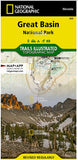
Great Basin National Park (TI-269)
Great Basin National Park, in eastern Nevada, is a great example of the rich biodiversity found throughout the expansive Great Basin region. From the sage-covered foothills to the 13,063-foot summit of Wheeler Peak, this single park covers multiple life zones, including desert shrub, piñon-juniper forests, and alpine environments. Some of the oldest living things on Earth, the gnarled bristlecone pines, live just below tree line. The park's remote location in eastern Nevada ensures some of the darkest night skies in the United States.
National Geographic's Trails Illustrated map of this unique park offers outdoors enthusiasts a valuable tool for exploring the park’s natural beauty and solitude. Expertly researched and created in partnership with Great Basin National Park, this map features trail networks in the park along with key points of interest including: Wheeler Peak, Lehman Caves, bristlecone pine groves, and the Snake Range. The map also includes two detailed inset maps of the Wheeler Peak and Baker Lake areas. The map base shows contour lines and elevations for summits, passes and many lakes. A variety of recreation features are noted as well, including campgrounds, trailheads, picnic areas, and scenic viewpoints.
Every Trails Illustrated map is printed on 'Backcountry Tough' waterproof, tear-resistant paper. A full UTM grid is printed on the map to aid with GPS navigation.
Copyright 2021