


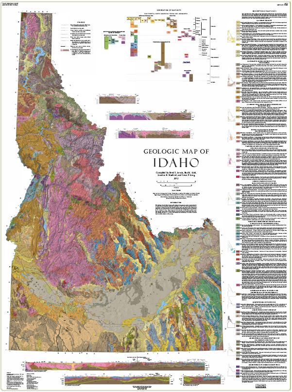

Geologic Map of Idaho
The Geologic Map of Idaho brings together the extensive mapping and associated research since the previous statewide compilation published in 1978. Over ninety geologic resources were used to compile the map (see accompanying booklet). The northern and western parts of the state were compiled by R. S. Lewis; the eastern and southeastern parts were compiled by P. K. Link and S. P. Long. The geology was initially drafted at 1: 500,000 scale, scanned, and the digitized. The shaded relief on the map was created from 10 m National Elevation Data and resampled to 30 m. All surficial unit contacts were modified by L. R. Stanford to reflect the detail of the shaded-relief base map. Idaho State Map M-9
The map comes with a booklet.
Other Information:
Compiled By: Reed S. Lewis, Paul K. Link, Loudon R. Stanford, and Sean P. Long, 2012Dimensions: 36" x 48"
Scale: 1: 750,000
Location: Idaho
Type: Paper, Poster, or Polypropylene map
Ships Rolled