


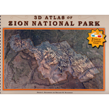
3D Atlas of Zion National Park
By: Steven L. Richardson and Benjamin M. Richardson
Utah's Zion National Park is one of the best known and loved travel destinations in the United States. Over the course of millions of years, the Virgin River eroded a deep gorge bounded by majestic vertical cliffs of ancient red and white sandstone, which are lined with hanging gardens and breathtaking waterfalls. Zion and its backcountry are popular year-round for joyful adventures that include touring, camping, hiking, canyoneering, and rock climbing. Covering an area of 407 square miles (1054 square kilometers), the maps in this book provide a detailed atlas of the entire park and its surrounding area in a completely new way.
To the casual observer, the maps in this book appear to be printed somewhat out of register, but when you put on a pair of red/cyan glasses, these same images emerge in eye-popping anaglyphic 3D, bringing the process of interpreting and understanding maps to a whole new level. As you examine the book, you will discover that each turn of the page reveals two views of the same area; the right page is part of a US Geological Survey topographic map, while the facing page is a color aerial photograph. When seen through the glasses, both show the peaks emerging above the page, while the canyons descend below the page surface. Together the pages in this book are an atlas of 39 detailed topographic maps accompanied by 39 aerial photographs, of which the maps and the photographs have been converted to anaglyphic 3D. Includes 2 pairs of 3d glasses.
Other Information:
Published: 2011
Pages: 86