


Interim Geologic Map of the Heber City Quadrangle, Summit and Wasatch Counties, Utah (OFR-712)
By: Robert F. Biek
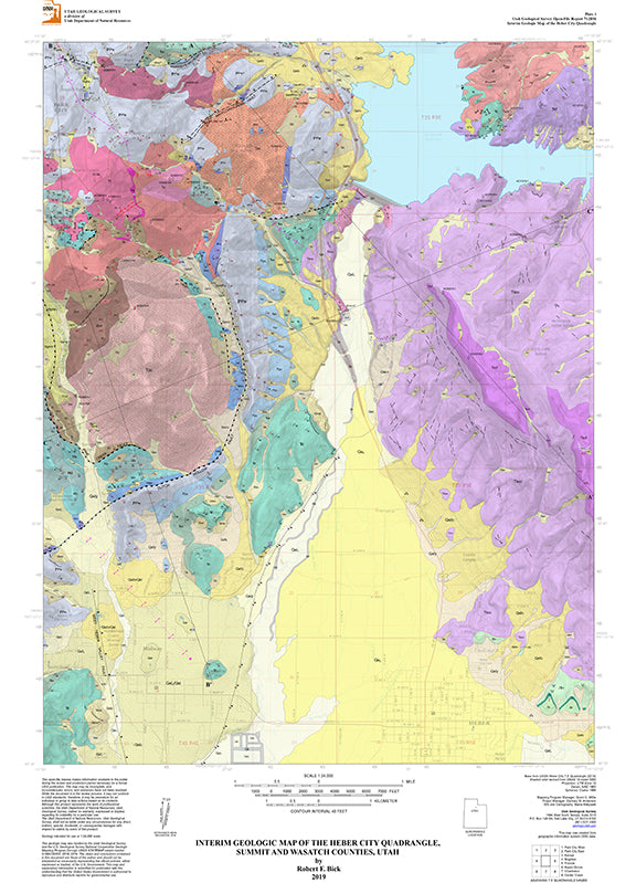
The Heber City quadrangle includes the northern half of Heber Valley and much of Jordanelle Reservoir. Parts of the Park City mining district and Deer Valley Resort, and much of Wasatch Mountain State Park, occupy the northwestern part of the quadrangle. The area’s geology is dominated by Paleozoic and Mesozoic shallow-marine and continental strata in the Wasatch Range, which host late Eocene to early Oligocene shallow intrusions collectively called the Park City porphyries, the source of mineralization in what was once one of the West’s most important silver-lead-zinc mining districts. Volcanic rocks derived from these and other nearby shallow intrusions dominate the eastern half of the map area. The town of Midway, at the west edge of the valley, is well known for its hot springs and calcareous tufa deposits. Numerous hiking, mountain biking, and Nordic ski trails make this a popular year-round recreational area.
Other Information:
Published: 2020
Plates: 2
Pages: 25
Location: Utah
Media Type: Paper Publication