


Interim Geologic Map of the Park City West Quadrangle, Summit and Wasatch Counties, Utah (OFR-697dm)
By: Robert F. Biek, W. Adolph Yonkee, and William D. Loughlin
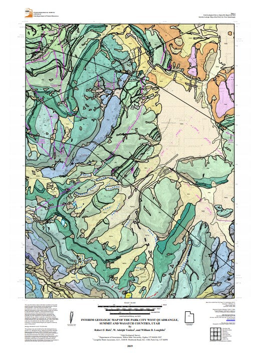
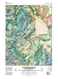
The Park City West quadrangle includes the crest of the Wasatch Range north of Big Cottonwood Canyon and the Park Meadows and Snyderville basins at the base of the rangeÕs eastern flank. The quadrangleÕs geology is dominated by Paleozoic and Mesozoic shallow-marine and continental strata exposed along the Uinta-Cottonwood arch and in the Mount Raymond thrust sheet that were folded and thrust faulted during the Sevier orogeny. Part of the Park City mining district, once one of the WestÕs most important silver-lead-zinc mining districts, is in the southeast corner of the quadrangle. Hiking and mountain biking trails and the Park City Mountain Resort make this a popular year-round recreational area.
Other Information:
Published: 2019
Pages: 20
Plates: 2
Scale: 1:24,000
Location: Utah
Media Type: Paper Map