


Geologic Map of the Farmington Quadrangle, Salt Lake and Davis Counties, Utah (M-279dm)
By: Mike Lowe, Stefan M. Kirby, and Kimm M. Harty,
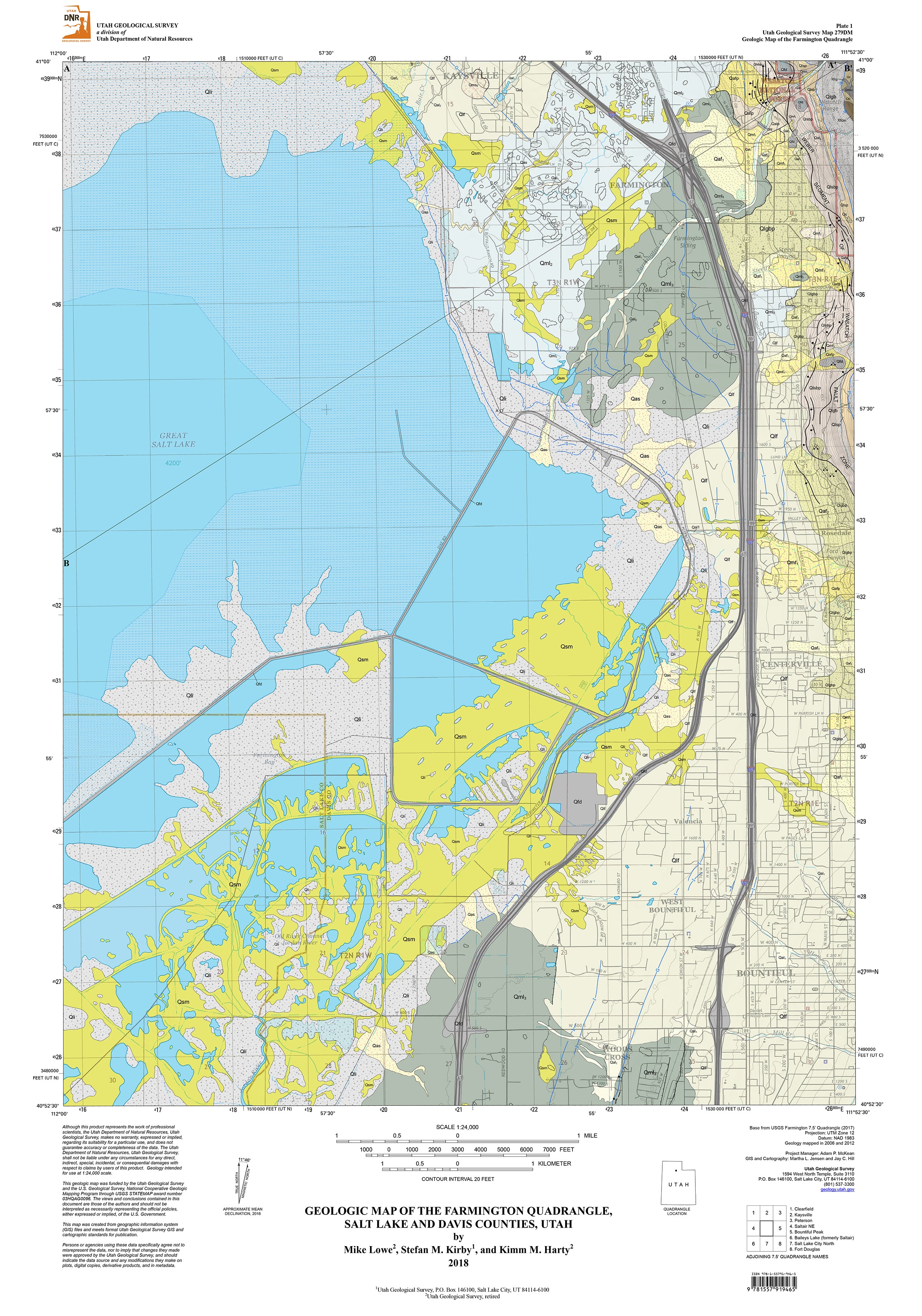
The Farmington quadrangle is located in Salt Lake and Davis Counties, northern Utah, and includes parts of the municipalities of Farmington, Kaysville, Woods Cross, and North Salt Lake. The quadrangle has igneous and metamorphic bedrock of the Farmington Canyon Complex in its northeast corner. The remainder of the quadrangle consists of unconsolidated deposits that include lacustrine, mass-movement, alluvial, paludal, and fluvial deposits. Mass-movement deposits include at least three generations of lateral spread deposits as well as various smaller landslide deposits. Scarps of the Weber segment of the Wasatch fault zone are mapped along the eastern boundary of the quadrangle. Most scarps are west facing and record episodic surface faulting along this segment of the Wasatch fault zone since the Pleistocene.
Other Information:
Published: 2018
Pages: N/A
Plates: 2
Scale: 1:24,000
Location: Utah
Media Type: Paper