


Geologic map of the Clear Creek Mountain quadrangle, Kane County, Utah (M-245)
M245
In stock
1:24,000 Geologic Maps
$14.95
By: M. D. Hylland
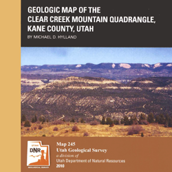
The Clear Creek Mountain quadrangle lies south of the Markagunt Plateau in southwest Utah, near the eastern border of Zion National Park. Exposed bedrock ranges from the Lower Jurassic Navajo Sandstone to the Upper Cretaceous Straight Cliffs Formation. Prominent among the Quaternary deposits are large landslide complexes involved the Cretaceous strata, including the Meadow Creek landslide that creates ongoing maintenance problems along State Route 9. Contains two plates ? the geology map and the explanation sheet ? both.
Other Information:
Published: 2010
Plates: 2 pl.
Location: Kane County
Media Type: Paper Publication