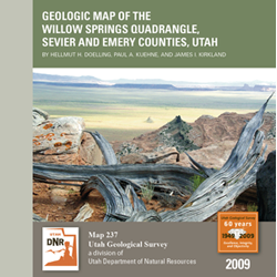
Geologic map of the Willow Springs quadrangle, Sevier and Emery Counties, Utah (M-237)
By: H. H. Doelling, P. A. Kuehne, and J. I. Kirkland
The Willow Springs quadrangle lies along the west edge of the Colorado Plateau physiographic province and the east edge of the High Plateaus, a transition zone between the Colorado Plateau to the east and the Basin and Range Province to the west, and is in the Colorado River drainage basin.
Previous mapping of the quadrangle is limited. It was first mapped geologically by Lupton at a scale of 1:62,500 as part of the U.S. Geological Survey coal-mapping program. With some modification, this map was used in the first geologic map of Utah at a scale of 1:250,000. Doelling mapped part of the quadrangle at 1:33,500 scale as part of a study of the Emery coal field, and Doelling remapped the quadrangle as part of a 1:100,000-scale mapping project. The present project expands upon the 1:100,000-scale mapping.
Other Information:
Published: 2009
Pages: 14 p
Plates: 2 pl.
Scale: 1:24,000
Location: Sevier County and Emery County
Media Type: Paper Map


