


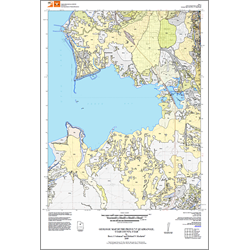

Geologic map of the Provo 7.5' quadrangle, Utah County, Utah (M-233)
By: B. J. Solomon and M. N. Machette
The bedrock of the Provo quadrangle consists of highly faulted sedimentary rocks of Mississippian to Precambrian age. These sedimentary strata are exposed in the Wasatch Range in the northeast corner of the quadrangle. Strata in the region were deformed by Late Cretaceous to early Tertiary contractional folding and faulting of the Sevier orogeny, early to middle Tertiary regional extensional collapse or relaxation, and late Tertiary to recent basin-andrange extensional faulting. The most prominent feature of the extensional faulting in the map area is the Provo segment of the Wasatch fault zone, which separates Utah Valley from the Wasatch Range.
This geologic map provides basic geologic information necessary to further evaluate geologic hazards and resources in the area, and to gain an understanding of the geology upon which this landscape developed.
Other Information:
Published: 2009
Plates: 2 pl.
Scale: 1:24,000
Location: Utah County
Media Type: Paper Map