


Geologic map of the Manti 7.5-minute quadrangle, Sanpete County, Utah (M-188)
By: M. P. Weiss and D. A. Sprinkel
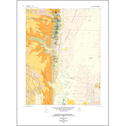
The Manti quadrangle lies in a region of structural transition between the extended lithosphere of the Basin and Range Province and the moderately deformed Colorado Plateau. In Late Cretaceous time this region was the leading edge of the Sevier orogenic belt. Bedrock strata exposed within the quadrangle range in age from Middle Jurassic (Callovian) through late Eocene. Jurassic strata antedate Sevier deformation and are exposed only within a zone of imbricate reverse faults along the eastern foot of the San Pitch Mountains (Gunnison Plateau), where two formations have a maximum exposed thickness of about 1,600 feet. Cretaceous strata (Aptian to Turonian) deposited in a foreland basin associated with the Sevier orogenic belt are locally present in outcrop and reached by wells in the Sanpete Valley. This part of the section is thinner in this quadrangle than farther north and the maximum exposed thickness of Lower Cretaceous beds is only about 512 feet. Only about 400 feet of Upper Cretaceous strata crop out in the Manti quadrangle. These Mesozoic beds were deformed by Sevier shortening and reverse faults have cut them into steeply dipping slabs along the front of the plateau.
Other Information:
Published: 2002
Pages: 22 p.
Plates: 2 pl.
Scale: 1:24,000
Location: Sanpete County
Media Type: Paper Map