


Preliminary geologic map of the Joes Valley Reservoir quadrangle, Emery and Sanpete Counties, Utah (M-67)
M67
In stock
1:24,000 Geologic Maps
$7.95
By: J. M. Kitzmiller II
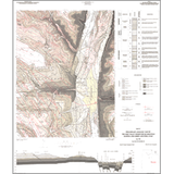
Joes Valley Reservoir quadrangle lies on the eastern side of the Wasatch Plateau in Emery and Sanpete counties. Drilling activity for coal has proceeded to the east edges of the area. Interest in expanding the Wasatch Plateau coal field reserve base has prompted this more detailed investigation of the surface geology in the quadrangle.
Other Information:
Published: 1982
Pages: 6 p.
Plates: 1 pl.
Scale: 1:24,000
Location: Emery County and Sanpete County
Media Type: Paper Map