


Geology, structure, and uranium deposits of the Escalante [1x 2] quadrangle, Utah and Arizona (I-744)
I744
Unstocked
1:250,000 Geologic Maps
$10.00
By: R. J. Hackman and D. G. Wyant
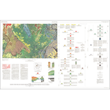
Geologic maps use a combination of colors, lines, and symbols to depict the relative age, composition, and relationships among rocks and sediments at and near the earth's surface.
Other Information:
Published: 1973
Plates: 1 pl.
Scale: 1:250,000
Color/B&W: Color
Location: Garfield County, Kane County, and San Juan County