


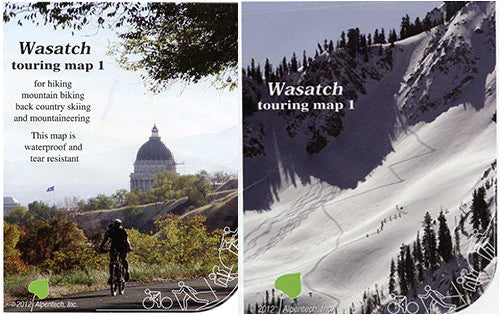


Wasatch Touring Map 1
Hike, Bike, and Ski
The popular summer hiking areas in City Creek has been added to the coverage of a completely overhauled reprint of Map 1. The scale of the new map is 20% larger, 1"=2500' and the paper size is just less than 27 x 39". Keeping with the similar Swiss Army fold, the 28-panel map is handy allowing easy re-folding for covering a tour in progress.
The photo side of the map features a fantastic winter panorama of the peaks in the Twin Peaks Wilderness with elevation references. An oblique photo panel shows tours originating in Little Cottonwood Canyon. An all-encompassing aerial photo shows Lambs Canyon to American Fork Canyons. Another new feature is an effort and ability rated hiking trail inventory with start and end metric UTM coordinates. We have also added photos and listing of invasive plants to be pulled, or reported by hiking parties.
Greater emphasis has been placed on mountain biking, thus the many popular bike trails, particularly in the Park City/Summit Park area have been added. Ski area boundaries and labeled lifts, as well as all the camping areas help staging and orientation in the field. A lot of time has been spent with Google Earth to verify routes, particularly mountaineering routes and less worn trails and available other published hiking maps were consulted and were checked with reviewers for rounding off the map makers own experience.
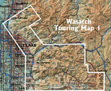
The base map is a composite of USGS 7.5 minute Quads and highlights land status by transparent color overlay. Unique to all recent Alpentech maps, a current Google ortho image is imbedded in the map. This is not instantly apparent but at closer inspection one finds a green tone reflecting actual tree cover roads and buildings. The wilderness boundaries had not changed after all, despite lengthy discussion in 2010/11 a new effort is in progress, so the users will have to look for changing boundary signs in a couple of years.
Known avalanches normally delineated by tree lines are highlighted with a light blue tone. Users must be aware that there exist many unknown, either less frequent or smaller, avalanche paths popular ski touring routes used for staging are mapped and avalanche fatalities are marked on the map. A general ski mountaineering rating is found for popular terrain.