


Interim Geologic Map of the Goshen Pass Quadrangle, Utah County, Utah (OFR-694dm)
By: Adam P. McKean
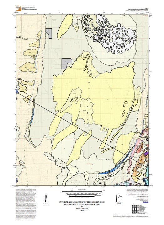
The Goshen Pass 7.5-minute quadrangle is located in the southern half of Cedar Valley in Utah County, Utah. Limited bedrock is exposed on the eastern and western boundaries of the quadrangle, and includes small hills and knobs of Mississippian to Pennsylvanian limestone and sandstone, as well as Tertiary volcanic and sedimentary rocks. Surficial geologic deposits consist of alluvial, colluvial, eolian, lacustrine, and marsh deposits. Late Pleistocene-age Lake Bonneville (30 to 13 ka) lacustrine deposits are prevalent over much of the quadrangle, and include a potentially ~18 ka Cedar Valley Lake (isolated from Lake Bonneville). Holocene eolian deposits cover approximately 15 square miles (~39 km2) of the quadrangle. On the east side of the quadrangle, the East Cedar Valley fault zone is Quaternary expression of continued basin-and- range extensional normal faulting.
Other Information:
Published: 2018
Pages: 15
Location: Utah
Media Type: Paper Publication